
Measure before choosing
Wall height, retained levels and upper-ground loads belong in the initial scope.
A coastal survey fieldbook
Retaining walls are ground, water and load systems. We help property owners assemble the evidence and questions needed for a clearer next conversation.
Why this focus exists
A leaning timber boundary, a new garden terrace and a wall supporting a driveway are not small variations of the same job. They begin with different loads, risks, records and decisions. The useful common starting point is a site brief that makes the retained levels, water, access and neighbouring improvements visible.
That brief helps an owner ask better questions without trying to perform remote engineering. It gives a contractor, designer or surveyor the same starting facts and makes omissions easier to see when written proposals are compared. It also leaves unknown conditions marked as unknown instead of turning them into confident marketing promises.
Retaining Wall Geelong provides planning information and an enquiry path for Greater Geelong properties. The selected contractor provides their own written scope and commercial terms. Structural design, surveys, permit decisions and regulated work remain with the appropriate property-specific professionals and authorities.
The operating principles
Wall height, retained levels and upper-ground loads belong in the initial scope.
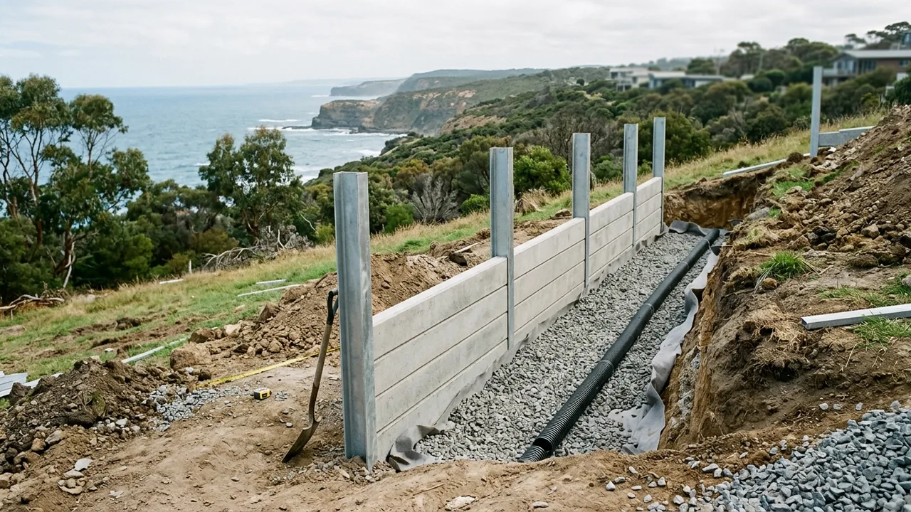
Drainage is considered from surface falls through filtration, pipe and lawful outlet.
General Victorian triggers are identified for confirmation by the appropriate property-specific professional.
Written quotes are compared across structure, access, drainage, approvals and exclusions.
Before requesting a scope
Begin with the approximate wall length and exposed retained height. Measure more than one point where the ground slopes or the wall steps. Photograph both ends, the face, the crest and the lower ground from a safe position. Add nearby fences, driveways, buildings, pools, sheds and trees because the upper-ground use can change the design question.
For an existing wall, note where leaning, bulging, cracking, rot, corrosion, loose blocks or soil loss appears. A long photograph along the wall is often more informative than a close view alone. Record when the issue was first noticed and whether it appears to change after rain or over time, but avoid declaring the cause before assessment.
Water deserves its own record. Look for ponding, staining, blocked outlets, surface falls, roofwater, erosion and damp retained soil. A pipe behind a wall is only one part of drainage; filtration, aggregate, grade, maintenance and a lawful outlet complete the path. The initial brief should show where water comes from and where it is believed to go.
Finally, measure gates, paths and overhead restrictions and identify the proposed area for machinery, material and spoil. Access is not a secondary detail. It can alter the wall system, demolition sequence, concrete method and reinstatement work. These observations do not replace a site inspection, engineering or permit advice. They organise the evidence those decisions need.
Facts
Dimensions, visible condition, access width, nearby loads, plans held and observed water movement.
Assumptions
Concealed footings, soil properties, service routes and the cause or urgency of movement before qualified review.
Decisions
Contractors, engineers, surveyors, building surveyors and authorities each confirm the parts within their role.
Bring the evidence
Photographs, dimensions, symptoms, plans and access notes are enough to begin. You do not need to choose an engineering solution before the property has been understood. Keeping each record dated also helps distinguish a current observation from an older plan or image.